First Alert Day: Strong to severe storms possible across Central NC Tuesday

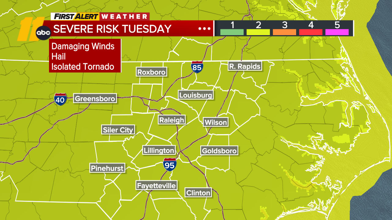
RALEIGH, N.C. (WTVD) -- First Alert Day-Tuesday: There is a slight risk (level 2 of 5) of severe storms Tuesday afternoon and evening. The main threat is damaging wind gusts, but large hail and isolated tornadoes will also be possible.
Good Tuesday morning! Acold front dropping south later today will bring the return of shower and thunderstorm chances during the afternoon and evening time frame. Storms should clear for most by midnight. Damaging wind gusts will be the primary threat, though hail, an isolated tornado, and flooding downpours are also possible.
Out-the-door temps are in the 60s and 70s. Highs will climb into the mid 80s north and upper 80s to low 90s from the Triangle and south.
RDU has picked up 11.13 inches of rain so far this month. That is 222% of the July historical average of 5.02 inches. The July monthly rainfall record is 12.36 inches, set in 1931. An additional 1.24 inches of rain could bring RDU to that record. Today will likely be our last opportunity to break the record, as drier air moves in behind tonight's cold front,
bringing a break from showers and thunderstorms through the end of July.
It will be quite pleasant through the end of July, with temperatures in the upper 80s and low humidity.
August begins with increasing clouds and perhaps a shower/storm Saturday night as a disturbance sweeps from the Midwest into the Mid-Atlantic. A front then approaches on Sunday and could bring a thunderstorm Sunday afternoon. The possibility remains that tonight's front lifts back north as a warm front, providing a catalyst for thunderstorms on
Sunday and Monday.
Tropics: No tropical development is expected in the Atlantic basin in the next 7 days.
Have a great day!
Kweilyn