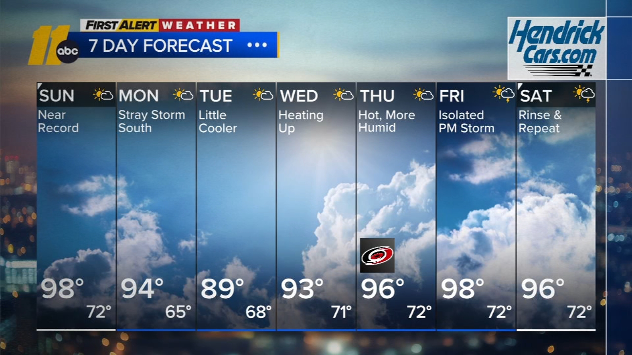
NC weather: Off and on rain today with chance of isolated severe storms


RALEIGH, N.C. (WTVD) -- Expect a day of off and on rain showers Thursday, with some of those rainstorms turning severe.
A cold front pushing through North Carolina will bring scattered showers and storms starting Thursday morning and lasting through the evening.
Much of central North Carolina was also under a Tornado Watch in effect until 9 p.m.
Click here to view the latest weather advisories.
Any of the storms could be strong or severe. However, areas east of Raleigh have a higher risk of those storms being severe.
The main concerns with the storms include damaging wind and hail. An isolated tornado is also possible.
Click here for First Alert Doppler XP
Temperatures in the region will be in the 70s, but once the cold front moves through those temperatures will drop--meaning most areas in the region will be in the 60s by Thursday evening.
TIMING
Showers are beginning to move into the Triangle on Thursday afternoon.
ABC11 Meteorologist Kweilyn Murphy said the highest chance for strong and severe storms is between 12 p.m. and 5 p.m.
By sunset, the storms should have moved out of the region.
Click here for the latest weather forecast.
All told, these storms will bring less than half an inch of rain to the majority of areas. Although some isolated locations where severe storms develop could see more than that--but the rain should not cause any widespread flooding.
Stay on top of the latest weather updates by downloading the ABC11 app