Rain returns, severe weather risk of downpours and damaging winds on Friday


RALEIGH, N.C. (WTVD) -- A warm front and weak cool front brought showers and storms through central North Carolina overnight Wednesday into Thursday morning.
Clouds will remain during the day and night as a much stronger disturbance moves in from the southern Plains and into the Ohio Valley, with a cold front coming later Friday evening. Expect temperatures in the 50s overnight with spotty showers across the Triangle.
Another round of rain is expected tomorrow night, lasting into Saturday morning. By the time you wake up we are done with the rain.
A better chance at thunderstorms still exists in the southern and western portions of the viewing area where clearing is possible and could provide a tad more instability.
Thunderstorms in the area could be capable of heavy downpours, and damaging winds in the evening hours.
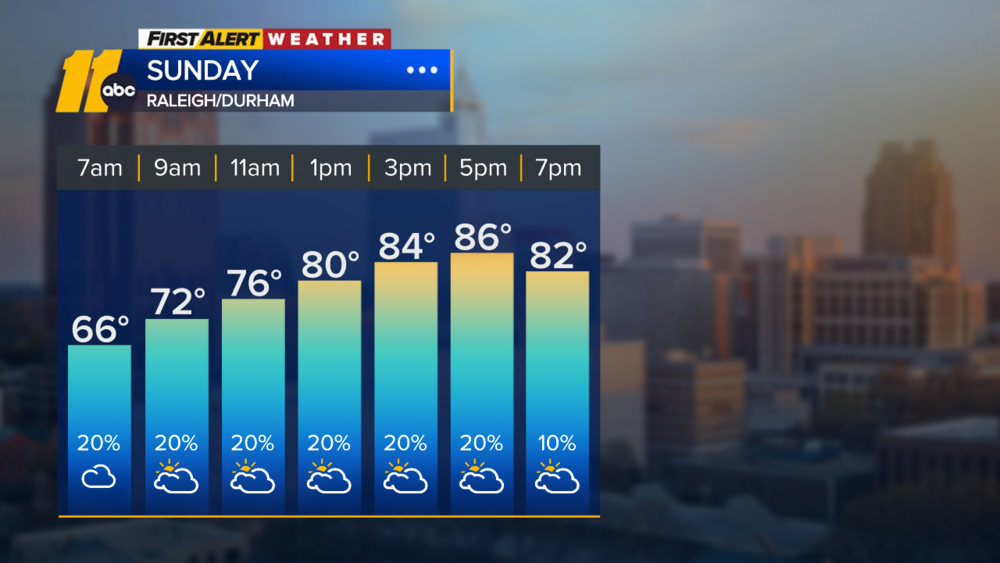
The good news is after this system passes, the weekend will be sunny and mild with temperatures still above the historical average.
Temperatures are expected to begin to dip on Sunday but could remain abnormally warm into early next week.