First Alert Day Friday


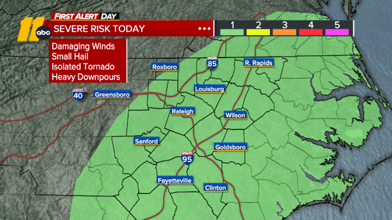
RALEIGH, N.C. (WTVD) -- First Alert Day-Today: Expect off & on scattered showers and storms today. There is a Level 1 of 5 risk for an isolated strong-to-severe storm, mainly this afternoon. Damaging wind and hail are the main concerns. Locally heavy rain may lead to street flooding.
Good morning! Scattered showers and storms will impact the area today, with more persistent rain possible through lunchtime. Off and on widely scattered showers and storms will be possible this afternoon through evening. Highs will be in the upper 50s and low 60s. With thunderstorms, a few gusty winds will be possible. The main isolated severe risk would be this afternoon as the surface low moves across the state. A shower or two will continue into the evening as the low moves off the coast.
Though the surface low will be over the Atlantic on Saturday, clouds will still linger throughout the day. A stray sprinkle or light shower can't be ruled out Saturday, with highs near 60. Skies will clear Saturday night as high pressure builds over the region.
After a dull end to the week and start of the weekend, sunshine will return on Sunday with high temperatures around 70 Sunday.
High pressure will push highs into the low to mid 80s Monday.
Another front is set to move through the region on Tuesday, bringing increased cloud cover, a breeze and another chance for spotty showers. We will then have to watch another cold front later in the week.
Have a great day!
Kweilyn