Severe weather risk increased for part of central North Carolina


RALEIGH, N.C. (WTVD) -- Tuesday is a First Alert Day as the severe weather risk has increased in central North Carolina.
The National Weather Service upgraded part of the ABC11 viewing area to a level 2 risk for severe storms.
The highest chance for severe storms is in the late afternoon through the evening. The biggest threat is that of damaging winds and maybe some hail.
An isolated tornado can't be ruled out, but the odds are low.

The areas most at risk of severe weather are in the northwest part of the viewing area, which includes Orange, Durham, Granville, Vance and Person counties.
Tuesday will get off to a cloudy start with a shower in spots and a severe weather risk in place for western parts of the Triangle.
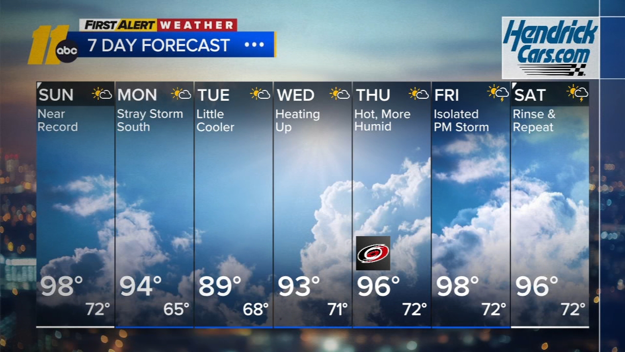
Wednesday will bring a mix of clouds and sunshine and temperatures around 80 degrees.
Then Thursday and Friday will see partly cloudy skies with temperatures in the 70s.