Umstead Coalition believes park border lines are incorrect near quarry site


RALEIGH, N.C. (WTVD) -- It's a natural gem many in our area rely on for hiking, biking and general outdoor enjoyment. Now, a group dedicated to preserving Umstead Park believes a controversial rock quarry project is eating up more land than allocated.
It all boils down to math and surveying. The Umstead Coalition argues that the no trespassing signs for the mining project along the border of Umstead Park should be 120 feet farther away. That may not sound like a lot, but when you extrapolate it out, it equals about 14 acres.
The group said it researched the original National Park Service maps and land deeds and compared them to online maps. The group then mapped out the border itself and believes the border has been incorrectly drawn.
"We're confident that we're correct. As I said, we've run a wheel; we've run a tape; we've done CAD. So we're confident that we're correct. Otherwise we wouldn't have you here today," Dr. Jean Spooner with the Umstead Coalition said.
Supporters said they are not sure what the reason was for the discrepancy. They admit technology was not as advanced decades ago when the map was drawn, but they also consider that it could've been don intentionally.
Either way, they want to put the state on notice, so if nothing else a little more of their oasis can stay.
SEE ALSO | Opponents applaud decision to reject second rock quarry at Umstead Park
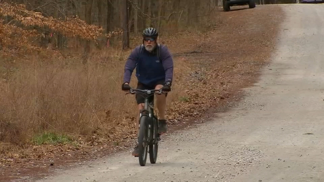
"So we cannot ignore it. It's an environmentally sensitive piece of property. Where you're standing right here is a proposed rock quarry, a 400 foot deep pit that is not an appropriate property for William Umstead Park," Spooner said.
The next step would be the state resurveying the land to see if they find the same mapping discrepancy. The State Parks division referred ABC11 to state administration, and so far that group has not responded.
RDU Airport Authority, which leased the property for the rock quarry project, tells ABC11 it has not been made aware of any discrepancy from the state, but both RDU and the quarry project leaders said they will adjust things if the lines end up being shifted. But as it stands right now, the project is set to move forward to begin mining potentially within two years.