Steamy, stormy next few days in central North Carolina

RALEIGH, N.C. (WTVD) -- LIVE RADAR
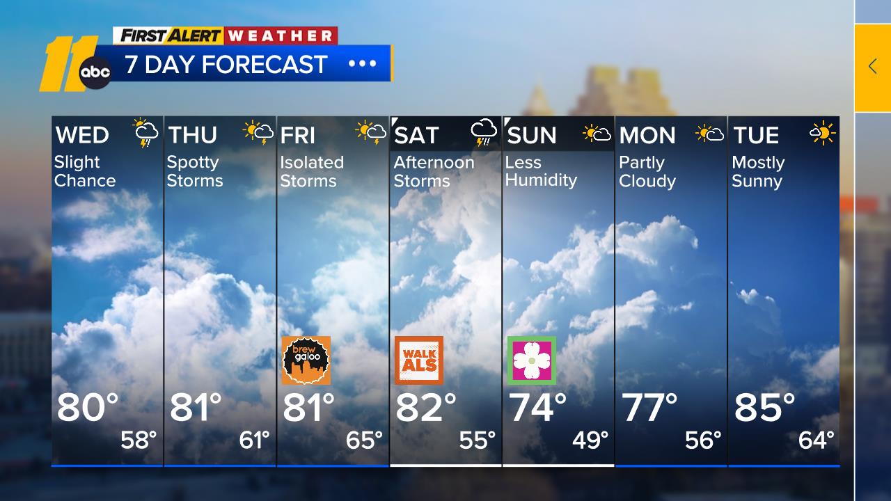
Tomorrow will be the hottest day this week as a ridge aloft reaches its peak intensity over the eastern Carolinas. Highs will be in the low 90s in most areas, but a few of the hot spots in the Sandhills and eastern portions of the Piedmont will push up into the mid-90s. As far as thunderstorm activity, the coverage of storms tomorrow should be similar to this afternoon, but there will be two notable differences. This first is that the storms form a little later in the afternoon or evening hours and are likely to continue into the first part of the overnight hours. The second difference is that any storms that form late tomorrow are likely to have a higher-than-usual risk of generating a microburst or two across the area.
Thunderstorms scattered about tomorrow evening diminish and end after midnight, but any break in the storms should be brief.
A strong trough digging southeast through the Midwest will be approaching the Carolinas Thursday afternoon and evening. Preceding cloud cover and the daytime arrival of the front will help to keep temperatures down before several thunderstorms develop during the afternoon. Some of the storms are likely to reach severe levels and can produce damaging winds, hail, and an isolated tornado or two, although the best support for these storms will pass by north of Raleigh. These storms will bring us heavy downpours, which will be more than welcome considering the lack of consistent rain for the past month.
By Friday, the cold front will be lying just off to our south, but it will be slowing in its southward movement. This may allow a developing wave of low pressure to move eastward along the cold front, slowing any clearing and perhaps bringing us a period of rain. Rain is most likely from Raleigh on south Friday.
In any case, the weekend looks comfortable with a mix of clouds and sun, pleasant afternoons, and dry, cool nights. A weak cold front may trigger a shower late Sunday or Sunday night.
Have a great evening!
Big Weather


